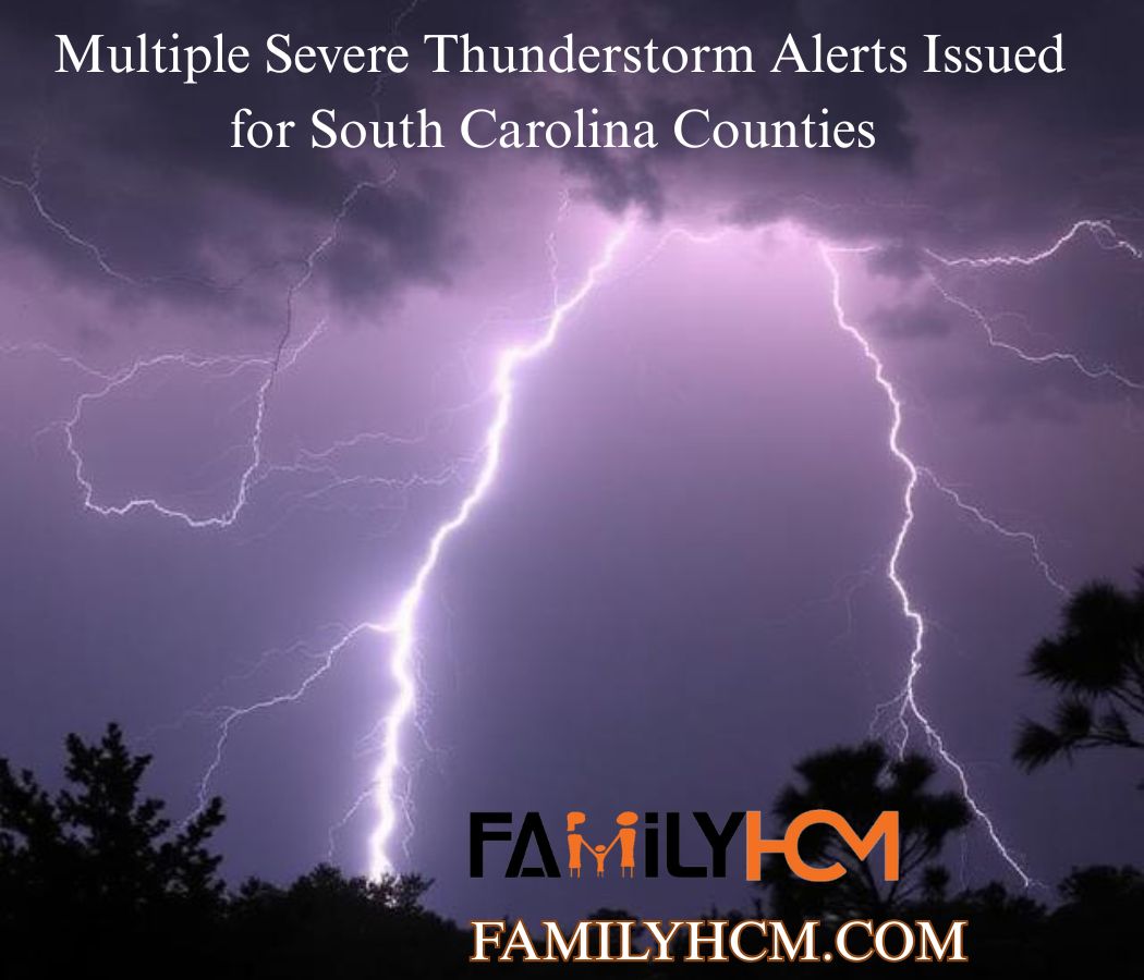
The sky over Summerville, South Carolina, took on that ominous greenish-gray hue on a recent Sunday afternoon. In a matter of minutes, what had been a pleasant day turned into a scene of howling winds reaching 60 mph, torrential rain, and the urgent buzz of a smartphone alert: a Severe Thunderstorm Warning had been issued for Berkeley, Charleston, and Dorchester counties. It’s a scenario playing out across the Palmetto State as a volatile spring weather pattern takes hold, prompting the National Weather Service to issue multiple severe thunderstorm alerts in quick succession.
If you live in or travel through counties like Newberry, Fairfield, Pickens, Richland, or Kershaw, you’ve likely seen these alerts flash across your screen. But what do they really mean? Why are so many being issued, and how can you ensure your family’s safety when the next one arrives?
This comprehensive guide breaks down everything you need to know about the recent wave of severe thunderstorm alerts in South Carolina. We’ll decode the language of the National Weather Service (NWS), provide actionable safety steps, and offer the insight you need to move from panic to preparedness.
Table of Contents
ToggleWhat’s Happening? The Recent Wave of Severe Thunderstorm Alerts
To truly understand the urgency of the situation, it helps to look at the specific warnings that have been impacting communities across the state. On a single Sunday in June 2026, the NWS was exceptionally active, issuing a series of severe thunderstorm warnings.
The Targets: Counties Under the Gun
The alerts painted a clear picture of the storm’s path, impacting a diverse swath of the state:
-
The Midlands: Newberry and Fairfield counties were placed under a warning until 3:45 PM, with Doppler radar tracking a strong line of storms capable of producing wind gusts up to 50 mph . The alert even warned of specific locations like the VC Summer Nuclear Station and highlighted a section of Interstate 26 between mile markers 62 and 89.
-
The Upstate: Pickens County faced a more severe threat. A warning was issued until 1:30 PM for a severe thunderstorm located near Six Mile, capable of producing wind gusts up to 60 mph. This storm was moving east at 35 mph, threatening areas like Easley, Pickens, and Lake Keowee.
-
The Lowcountry: The final and perhaps most significant warning of the day was issued for Berkeley, Charleston, and Dorchester counties. A severe thunderstorm was located directly over Summerville, moving east at a slower 20 mph, but packing a punch with 60 mph winds. This storm threatened major population centers, including North Charleston, Mount Pleasant, Goose Creek, and critical roadways like I-26 and I-526.
The Timeline: A Day of Alerts
This wasn’t a single, isolated event. It was a volatile weather day where multiple severe thunderstorm warnings were issued at staggered times across different regions. This pattern demonstrates how a larger storm system can spawn individual, dangerous cells that move across the state, each requiring its own specific warning. Residents in the Charlotte region also experienced expired watches and warnings as the system moved through the Carolinas.
This flurry of activity underscores a vital point: severe weather is a dynamic, rapidly evolving threat. Staying informed requires more than just checking the weather once in the morning. It means having multiple, reliable ways to receive alerts throughout the day.
The Crucial Difference: Watch vs. Warning
One of the biggest sources of confusion during severe weather is understanding the difference between a Watch and a Warning. South Carolina Emergency Management officials have highlighted this as a key area of misunderstanding during their annual Severe Weather Safety Week.
The distinction is simple but critical:
-
Severe Thunderstorm Watch: Be Prepared. A watch means conditions are favorable for severe thunderstorms to develop in and near the watch area. Think of it as a “heads up.” The ingredients are in the atmosphere for a storm to form, but one hasn’t been spotted or indicated by radar yet. Watches cover a large area, are often in place for several hours, and are your signal to review your safety plan and stay tuned to weather updates.
-
Severe Thunderstorm Warning: Take Action Now! A warning is the “red alert.” It means a severe thunderstorm has been indicated by Doppler radar or reported by a trained spotter. The key criteria for a severe thunderstorm warning are wind gusts of at least 58 miles per hour OR hail measuring at least one inch in diameter (about the size of a quarter). When you hear a warning, the threat to life and property is imminent. The warnings issued for Pickens and the Lowcountry were examples of this; the threat was real and occurring.
Watches vs. Warnings vs. Advisories
It’s also helpful to know that a third, less urgent category exists: Advisories. An advisory means potentially hazardous weather is occurring or is expected, but its impacts are less severe than those associated with a warning. For example, a wind advisory might be issued for gusty but non-damaging winds, whereas a warning implies imminent danger.
Understanding this hierarchy empowers you to react appropriately. A watch prompts planning, while a warning demands immediate, life-saving action.
Why South Carolina? The Science Behind the Storms
South Carolina is a hotbed for spring and summer severe weather. Several geographical and atmospheric factors create a perfect breeding ground for powerful thunderstorms.
The Spring Transition
The state’s climate is in constant flux. In early 2026, South Carolina experienced a transition from the cool La Niña weather pattern. This shift often brings warmer and potentially drier conditions, but it also creates a volatile atmosphere where warm, moist air from the Gulf of Mexico collides with colder, drier air from the north. This clash is the primary engine for severe thunderstorms. The NOAA’s spring 2026 outlook predicted that even with warmer temperatures, severe weather events like thunderstorms and tornadoes would remain a significant possibility.
The Specific Triggers
Certain conditions fuel these storms, leading to the widespread warnings we saw.
-
Rapid Uplift: When the atmosphere is unstable, warm air near the surface rises rapidly. This updraft can carry moisture high into the atmosphere, where it cools and condenses into towering cumulonimbus clouds—the classic thunderstorm cloud.
-
Wind Shear: Changes in wind speed and direction at different heights in the atmosphere cause the storm to rotate. This “wind shear” is what can turn an ordinary thunderstorm into a severe one, increasing its intensity and lifespan.
-
Heat and Moisture: The warm waters of the Atlantic Ocean and the Gulf of Mexico provide a virtually limitless supply of moisture and energy to fuel these storms. As the climate warms, this fuel source only becomes more potent, potentially leading to more frequent and intense severe weather events.
How to Stay Safe: Actionable Advice for You and Your Family
When a severe thunderstorm warning is issued for your area, every second counts. The NWS offers clear, life-saving guidance.
Immediate Action (When a Warning is Issued)
-
Seek Shelter Immediately: Move to a well-built structure and get to an interior room on the lowest floor. Stay away from windows and glass doors. The goal is to put as many walls between you and the storm’s violent winds as possible.
-
Heed the “30-30” Rule for Lightning: Lightning is a significant threat during any thunderstorm. Once you hear thunder, you are already at risk. The NWS recommends going indoors and staying there until 30 minutes after the last clap of thunder. This is a simple, effective rule to avoid being struck by a lightning bolt.
-
Avoid Contact with Conductors: When inside, stay away from corded phones, electrical equipment, plumbing, and windows. Water and metal are excellent conductors of electricity, and a lightning strike can travel through your home’s wiring and pipes.
-
Never Drive Through Flooded Roads: Severe thunderstorms often bring torrential rainfall that can quickly flood roadways. The NWS provides a stern warning: do not drive your vehicle through flooded roadways. It only takes a few inches of water to lose control of a car or to have it swept away.
What to Do if You’re Caught Outside
If you are in a car or outdoors and cannot reach a sturdy shelter:
-
In a Vehicle: Stay inside the car with the windows rolled up. Do not touch any metal surfaces. If possible, pull over and put your head below the windows. A car’s metal frame can provide some protection, but it is not a guarantee of safety.
-
Outdoors: If you are in an open field, a forest, or a camping site, your options are limited. The NWS recommends:
-
Stay away from open fields, hilltops, and ridge tops.
-
Avoid tall, isolated trees or other tall objects. If in a forest, stay near shorter trees.
-
If you are in a group, spread out to prevent the lightning current from passing between people.
-
If camping in an open area, set up camp in a valley, ravine, or other low spot. Remember, a tent provides no protection from lightning.
-
Stay away from water, wet items, and metal objects.
-
Common Mistakes and Challenges (And How to Avoid Them)
Even with the best information, people often make mistakes during severe weather that put them at risk.
-
Confusing a Watch and a Warning: As we’ve seen, this is perhaps the most common error. Mistaking a watch for a warning can lead to complacency. Solution: Remember the simple rule: A Watch is a “heads up,” and a Warning is a “call to action.”
-
Ignoring the Alerts: “It’s just another storm; it will pass.” This mentality can be deadly. Severe storms are unpredictable and can intensify rapidly. Solution: Treat every severe thunderstorm warning as a genuine threat. Take immediate shelter and monitor the situation.
-
Not Having a Plan: Waiting for a storm to hit before deciding what to do is a recipe for panic and poor decisions. Solution: Develop a family emergency plan. Designate a safe room in your home and practice going there. Ensure every family member knows what to do and where to go.
-
Relying on a Single Alert Source: Smartphones are fantastic, but batteries die, and cell towers can be damaged. Solution: Have multiple ways to receive alerts. This includes a NOAA Weather Radio, local TV and radio stations, and smartphone apps.
Beyond the Alert: Pros, Cons, and a Balanced View of the Warning System
The NWS warning system is a powerful tool that saves lives, but no system is perfect. A balanced perspective reveals both its strengths and limitations.
Pros of the Current System
-
Life-Saving Alerts: The primary function of the system is to save lives and protect property, which it does effectively when heeded. The warnings issued in 2026 gave residents crucial lead time.
-
Scientific Accuracy: Using Doppler radar and advanced forecasting models, the NWS can pinpoint the location and intensity of severe weather with remarkable accuracy.
-
Multiple Dissemination Channels: The system can broadcast alerts through NOAA Weather Radios, cell phones (via WEA), TV, and radio, reaching a broad audience.
-
Clear Criteria: The specific criteria for issuing a warning (58 mph winds, 1-inch hail) make the process objective and consistent.
Cons and Challenges
-
The “False Alarm” Problem: Because warnings are issued for a specific geographical area that might be quite broad, not everyone in the warned zone will experience severe conditions. This can lead to complacency, where people ignore future warnings.
-
Rapidly Changing Storms: Severe storms can change intensity, direction, and speed very quickly. A warning can sometimes be issued just minutes before a storm hits, leaving little time to react.
-
Dependence on Technology: The system’s effectiveness relies on a robust infrastructure. If cell towers or power grids fail, information delivery can be disrupted.
-
Heuristic Bias: People often rely on their own past experiences to judge a current risk. “I’ve been through dozens of warnings and nothing has happened to me” is a dangerous form of heuristic bias.
The Future of Severe Weather Alerts
The world of weather forecasting is always evolving. Here are some predictions for the future of severe weather alerts:
-
More Precise, “Storm-Scale” Warnings: Instead of warnings for whole counties, the NWS is working towards issuing warnings for much smaller, more specific areas. This will reduce the number of “false alarms” for those outside the direct path of a storm.
-
Improved Lead Times: Advanced satellite technology and improved computer models will likely increase the lead time before a storm hits, giving people more time to prepare.
-
Integration with AI: Artificial intelligence is already being used to analyze vast amounts of weather data. AI could help forecasters identify severe weather patterns faster and more accurately than ever before.
-
Hyper-Local Impact Forecasts: Future alerts may go beyond “wind gusts of 60 mph” to predict the specific impacts in a neighborhood, such as, “Tree falls likely on Oak Street due to saturated ground and wind gusts.”
Conclusion: Your Safety Starts with Awareness
The multiple severe thunderstorm alerts issued for counties across South Carolina serve as a powerful reminder of nature’s power and the importance of being prepared. While the science and technology behind forecasting are impressive, your personal safety ultimately depends on your understanding and response.
By learning the critical difference between a watch and a warning, having a plan, and taking immediate action when an alert is issued, you can dramatically increase your safety and the safety of your family.
Key Takeaways
-
Know the Lingo: A Watch means conditions are favorable for severe weather (Be Prepared). A Warning means severe weather is happening (Take Action Now!).
-
Take Action Immediately: When a warning is issued for your county, seek shelter in a sturdy building immediately, moving to an interior room on the lowest floor away from windows.
-
Heed the “30-30” Rule: If you can hear thunder, you are close enough to be struck by lightning. Wait 30 minutes after the last thunderclap before going outside.
-
Turn Around, Don’t Drown: Never attempt to drive through a flooded roadway. The water can be deeper and faster-moving than it appears.
-
Have a Plan: Don’t wait for the storm to hit. Develop a plan now for where you will go and what you will do during a severe thunderstorm.
Stay informed, stay prepared, and stay safe, South Carolina.
Frequently Asked Questions (FAQs)
1. Should I be scared of a severe thunderstorm warning or a watch?
No, you should not be “scared,” but you should be alert and aware. A watch is a call to prepare and be ready. A warning is a call to take immediate action to protect your life. Your response should be measured and informed, not driven by panic. Have a plan, follow the steps, and you will be safe.
2. What should I do if I get a severe thunderstorm warning while I’m at work?
Your workplace should have a severe weather safety plan. Follow the directions of your building’s management or safety officers. If no plan exists, move to an interior room away from windows and skylights. Avoid elevators and large, open spaces like auditoriums or warehouses with high ceilings.
3. I live in an apartment on the 7th floor. Where should I go during a warning?
This is a common concern. The safest place in an apartment is generally an interior room on the lowest floor you can access. This could be a bathroom, a closet, or a hallway. If you can get to a ground-floor hallway or a basement, that is even better. The key is to put as many walls between you and the outside as possible.
4. Is it safe to watch the storm from my window?
No. The NWS explicitly warns against this. Flying debris can shatter windows, and the strong winds can compromise the structural integrity of a building. Move to an interior room away from all windows and glass doors.
5. What is the difference between a Severe Thunderstorm Warning and a Tornado Warning?
A severe thunderstorm warning means a storm is capable of producing damaging winds (58+ mph) or large hail (1″ or more). A tornado warning is much more urgent and means a tornado has been indicated by radar or has been spotted by a trained observer. If you receive a tornado warning, the action is the same (seek shelter), but it’s critical to find shelter in a basement or a small, windowless interior room on the lowest floor. Additionally, a Tornado Watch was often in effect during the severe thunderstorm warnings, which means conditions were favorable for tornadoes to develop. As of the time of the warnings, there was no active Tornado Warning in the specific counties we detailed, but the threat was present in some areas.
Sources
This article was written using information from the following sources:
-
The State. “Weather alert for strong thunderstorms in Newberry and Fairfield counties Sunday afternoon.” June 14, 2026.
-
The State. “Severe thunderstorm warning active for Pickens County Sunday afternoon.” June 14, 2026.
-
South Carolina Public Radio. “Know the difference between a watch and a warning.” March 9, 2026.
-
The State. “Prepare for damaging winds with thunderstorms in Lowcountry Sunday, says the NWS.” June 14, 2026.
-
WCBD News 2. “Know the difference: Severe thunderstorm vs. tornado watches and warnings.” March 16, 2026.
-
Iowa Environmental Mesonet. “KCAE Severe Thunderstorm Warning #15.” March 16, 2026.
-
Greenville Online. “Is it spring yet? NOAA 2026 weather outlook for South Carolina.” February 11, 2026.
-
Clemson News. “Prepare for storms during Severe Weather and Flood Safety Week.” March 5, 2026.
-
WBTV. “Tracking active vs. expired weather alerts as severe storms move through Charlotte region.” March 16, 2026.